The Blue Ridge Parkway Set of 6 Maps
Description: Maps 1-6
- Contains All 6 Maps which trace the Blue Ridge Parkway from Waynesboro, Virginia to Cherokee, North Carolina
- Each Map Numbered in sequential order for easy selection
- Every paved road and exit on the Blue Ridge Parkway identified
- Nearest Reliable Gas Stations to each parkway exit shown
- All major sights included on and off the Parkway
- Venture off the Parkway with confidence using the most enjoyable rides
- Explore and discover sights, areas and great rides others miss
- Free yourself from the hassles of unplanned crowded detours
- Make the most of your valuable time by knowing every great ride close to you wherever you are
- Enjoy the freedom to go off on your own path confident you can find your way
- Don't waste your free time sitting at a motel, there's always a great road nearby
- Waterproof and durable
Details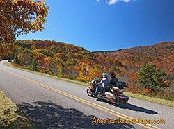
The Complete Blue Ridge Parkway Series is designed to take your trip on the Blue Ridge Parkway from a 2 dimensional one-road ride to a 3 dimensional explosion of fabulous motorcycle adventures. From any vantage point, any overlook along the 469 mile scenic roadway, know what great undiscovered motorcycle rides lie not only within all you can see, but beyond the horizon.
Other maps may show where the roads are, but none of them show you which ones are worth riding like the maps in the Complete Blue Ridge Parkway series. There are thousands of miles of classic motorcycle rides identified on these maps. You can literally ride to one end of the Blue Ridge Parkway, then return back again via a completely new route comprised entirely of the some of the best two-lane motorcycle rides in the world. I know, I've done it, more than once, and a different way each time!
Don't think the Complete Blue Ridge Parkway series is just for through-riders. After all, the point of the Blue Ridge Parkway was to open up and introduce travelers to the Smoky Mountains. Once you're introduced, let the party begin! No matter where you choose along the scenic roadway, it is the surroundings that make it so special. Don't be limited to the confines of the park. Enjoy the freedom to explore every nook and cranny of this beautiful, scenic, and historic region and discover the wonders and adventures that hide just beyond the next hilltop.
Make the best use of your precious motorcycle ride time, get the most out of your valuable motorcycle vacation time, use the amazing information revealed on these maps to discover one of the best kept secrets - there is more great motorcycle riding concentrated in the mountains of the eastern United States than anywhere else on earth. The maps unlock the door to some of the best of them.
This package includes the 6 maps which best describe the course of the Blue Ridge Parkway from Waynesboro, Virginia, to Cherokee, North Carolina, as well as directing you to the best paved roads found in the surrounding mountains.
- Every Great Road which crosses, is adjacent to, or within the mountains surrounding the Blue Ridge Parkway is described in detail
- Miles Between each road and exit is shown
- Reliable and remotely located Gas Stations are identified
- Points of Interest, Parks, Forests, Cities and Towns included
- Each map contains days and days of great riding
- At least a dozen great roads on each map, some list more than 40!
- A brief description of each route helps you choose which ones to ride
Features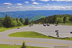
- Maps Overlap and Connect
- Adjacent maps indicated on each
- Keep just the maps you need for the day handy in your pocket
- No messing around with a huge maps that are expensive, hard to fold, and get stowed away out of reach
- Handy, easy-to-use, accessible pocket map size
- Best Rides boldly highlighted in red
- Good Connecting Roads highlighted in blue
- Rides described on back of map
- Mileage between road segments shown
- Out-of-town and remote gas stations identified
- Selected Dealers / Repair shops shown
- Ride times / distance included with descriptions
- Scenic points, waterfalls, etc. shown
- Waterproof version available
Map Specifics: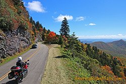
- Size (unfolded) - 11 x 17 inches
- Size (folded) - 4 1/4 x 5 1/2 inches
- Fast, simple, easy folding
- Layout - Full color map on one side with detailed directions on the back
- Easy to read color-coded road labels to aid navigation
- Arrows indicate when turning onto a new road on selected routes
- 3 map "Smoky Park" Map set (Maps 6-8)
- 6 Map "Blue Ridge Parkway " Map set (Maps 1-6)
- 7 Map "Blue Ridge Parkway PLUS the Dragon " Map set (Maps 1-7)
- 9 Map "Full Southeast Package " Map set (Maps 1-9)
