#2 The Roads Of Roanoke and Beyond
On This Map:
- 300+ Miles of Great Motorcycle Riding highlighted
- Closest gas station to each parkway exit listed
- 200+ miles of the best routes are indicated in red
- 100+ miles of good connecting roads highlighted in blue
-
Scenic points, motorcycle-friendly stops, etc. shown
- Map #2 in the 6 Map Blue Ridge Parkway Set
- Remotely located (out-of-town) gas stations identified
- Handy, easy-to-use, accessible pocket map size
- Waterproof and durable
- Best rides boldly highlighted in red
- Good connecting roads highlighted in blue
- Rides are described on back of map
- Mileage between road segments shown
- Overlaps and connects with adjacent maps
Description of area: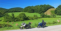
This map covers the great motorcycle roads found in the central mountains of Virginia. The highest ridge lines of the mountains are traced by 90 miles of the Blue Ridge Parkway which skirts the southern and eastern side of the city of Roanoke, the largest city along the 469 mile scenic roadway. The mountains gain height as you go north from the city, and are lower and more rolling to the south. The Smokies in this region are distinctly separated by long valleys a ripe with some spectacular motorcycle rides. There are also urbanized areas where the riding is not as enjoyable you will want to avoid. This map will help you choose the best routes, and select the least congested and most entertaining rides when you find you must pass through the more developed areas.
Centered on the sprawling city of Roanoke, this motorcycle pocket map is complimented by maps north and south which give complete coverage of the Blue Ridge Parkway in this state. Few paved roads intersect the Blue Ridge Parkway through this region. Some of these are not much fun to ride. Others, highlighted in blue, are good roads to choose for making connections to the better rides found in the more remote areas surrounding the Blue Ridge Parkway. Find great roads within the urban landscape and how to make the quickest or most enjoyable excursions to those which lie nearby.
The best rides, highlighted boldly in red,, offer some spectacular scenery and challenging curves through some of the most beautiful pastoral countryside often tracing the serpentine course of rushing streams and rivers through rugged and picturesque valleys or over high scenic passes. While there are some great motorcycle rides which connect directly to the Blue Ride Parkway, for the traveler who has a little extra time to wander, the rides beyond the nearest hilltop are worth the trip. This motorcycle map will guide you to them and put you on some of the best rides in areas that seem so remote and lost in time you'll forget the big city is just beyond the horizon.
Features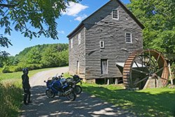
- 90 miles of the Blue Ridge Parkway
- Peaks of Otter Visitors Center
- National D-Day Memorial in Bedford
- Parkway exits are highlighted
- Roads which connect to the Blue Ridge Parkway clearly identified
- Historic Towns
- Blue Ridge Parkway Visitor Center Roanoke
Cities and Towns on this map:
Virginia: Blacksburg, Christiansburg, Floyd, Radford, New Castle, Pembroke, Shawsville, Riverside, Ferrum, Rocky Mount, Boone's Mill, Roanoke, Webster, Buchanan, Bedford, Lynchburg, Alta Vista, Hurt, Gretna, Fincastle, Troutville
Map Specifics: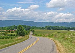
- Size (unfolded) - 11 x 17 inches
- Size (folded) - 4 1/4 x 5 1/2 inches
- Fast, simple, easy folding
- Layout - Full color map on one side with detailed directions on the back
- Easy to read color-coded road labels to aid navigation
- Mileage between roads is indicated
- Reliable and remote gas stations are shown
- Numerous points of interest
Know Your Blue Ridge Map Options:
-
Map #2 is sold a a single map
-
Map #2 is part of the 6 Map "Blue Ridge Parkway " Map set (Maps 1-6)
-
Map #2 is part of the 7 Map "Blue Ridge Parkway PLUS the Dragon " Map set (Maps 1-7)
-
Map #2 is part of the 9 Map "Full Southeast Package " Map set (Maps 1-9)
-
Map #2 is sold a a single map
-
Map #2 is part of the 6 Map "Blue Ridge Parkway " Map set (Maps 1-6)
-
Map #2 is part of the 7 Map "Blue Ridge Parkway PLUS the Dragon " Map set (Maps 1-7)
-
Map #2 is part of the 9 Map "Full Southeast Package " Map set (Maps 1-9)
