#5 The Best Rides North and South of Asheville, NC
On This Map:
- Closest gas station to each parkway exit listed
- More than 50 different superb rides located in the surrounding area
- Highest Mountain in the East - Mt. Mitchell
- Map extends into South Carolina and Tennessee
-
Scenic points, waterfalls, motorcycle-friendly stops, etc. shown
- Map #5 in the 6 Map Blue Ridge Parkway Set
- Remotely located (out-of-town) gas stations identified
- Handy, easy-to-use, accessible pocket map size
- Waterproof and durable
- Best rides boldly highlighted in red
- Good connecting roads highlighted in blue
- Rides are described on back of map
-
Mileage between road segments shown
- Overlaps and connects with adjacent maps
Description of area:
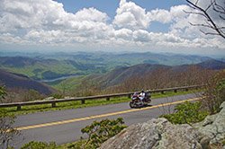
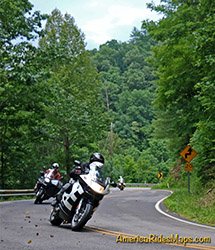
The highest mountains in the east are found north of Asheville, North Carolina, crossing the border into Tennessee. The extreme terrain has left most of this spectacular area wild and remote with only a sparse scattering of small historic mountain towns. The great two lane roads that wind and twist through, around, and over these hills and valleys deter most commercial and tourist traffic leaving them for the motorcycle rider to enjoy. The area covered on this motorcycle ride map runs from Asheville, NC, to Johnson City, TN, in the north, to Marion, NC, in the east, and includes the roads south to Lake Lure, NC. In addition to the great motorcycle rides found within the mountains, this motorcycle map includes 84 miles of one of the most remote high sections the Blue Ridge Parkway.
Even as you draw near urban Asheville, roads lead from the heart of the city to the heights of the Blue Ridge Parkway within just a few miles, snaking their way up the steep hills which surround town. It is the territory to the north of Asheville which holds some of the finest motorcycle rides rides, long wonderful winding roads that make an adventure of revealing the mountains beauties and majesty. Those who wish to stay closer to the Blue Ridge Parkway or the Interstate highways will be rewared with the roads which course through the mountains north and south of the city, rides which take you through and around dramatic Hickory Nut Gorge and Lake Lure.
This motorcycle ride map catalogues 400 miles of the best two lane back roads in the area. The major highways and roads are included so you can easily reach them to build loops that will provide days and days of great motorcycle riding or avoid the four lane routes completely on the great roads listed. This map takes great pains to steer you off the roads that carry the bulk of the traffic or pass through congested areas and get you on the roads that will keep your motorcycle cruising through the fantastic scenery and coming round the Smoky Mountains.
Features
- 84 miles of the Blue Ridge Parkway
- Mt. Mitchell State Park - highest mountain in the east
- Lake Lure / Chimney Rock / Hickory Nut Gorge
- Roan Mountain State Park
- Craggy Gardens
Cities and Towns on this map:
Tennessee: Elizabethton, Erwin, Unicoi, Flag Pond, Hampton, Jonesborough, Roan Mountain
North Carolina: Asheville, Black Mountain, Fletcher, Fairview, Swannanoa, Old Fort, Spruce Pine, Burnsville, Bakersville, Weaverville, Mars Hill, Montreat, Marion, Old Fort, Bat Cave, Elk Park, Newland, Crossnore, Linville Falls, Nebo, Woodfin, Barnardsville, Beech Mountain, Green Mountain
Map Specifics:
- Size (unfolded) - 11 x 17 inches
- Size (folded) - 4 1/4 x 5 1/2 inches
- Fast, simple, easy folding
- Layout - Full color map on one side with detailed directions on the back
- 400 miles of the best routes are indicated in red
- Easy to read color-coded road labels to aid navigation
- Mileage between roads is indicated
- Reliable and remote gas stations are shown
- Numerous points of interest
- Dealer / Repair facilties shown
