#7 The Best Motorcycle Rides Near Smoky Park - SOUTH
On This Map:
- More than a dozen Roadside Waterfalls
- 30+ Best Rides
- 20+ Good Connecting rides
- Scenic points, waterfalls, motorcycle-friendly stops, etc. shown
- Map #6 in the 6 Map Blue Ridge Parkway Set
- Remotely located (out-of-town) gas stations identified
- Handy, easy-to-use, accessible pocket map size
- Waterproof and durable
- Best rides boldly highlighted in red
- Good connecting roads highlighted in blue
- Rides are described on back of map
-
Mileage between road segments shown
- Overlaps and connects with adjacent maps
Description of area: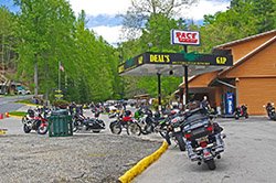
This map describes the very westernmost portion of North Carolina and the border lands of Tennessee, includes the south half of Great Smoky Mountains National Park, and portions of Georgia and South Carolina.
The three things that draw the most motorcyclists to the southern Appalachian Mountains are The Blue Ridge Parkway,Great Smoky Mountains National Park, and Deals Gap. The Parkway reaches it's southern end at Cherokee, near the south entrance to Great Smoky Mountains National Park, and Deals Gap, home to the infamous "Tail of the Dragon ™" is less than an hour west.
Of all the roads in the Appalachian Mountains, the most notable (after the Blue Ride Parkway) is the section of US 129 which crosses the North Carolina / Tennessee border popularized as "The Tail Of The Dragon™" at Deals Gap. Infamous for its challenging collection of 318 curves within its 11 mile stretch through the Gap at the southwest corner of Great Smoky Mountains National Park, both motorcyclists and car enthusiasts make the pilgrimage to enjoy the challenge. Also included is another great road leading into Deals Gap from the east - "The Hellbender 28".
Features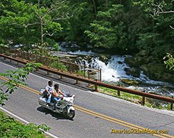
- Wheels Through Time motorcycle museum, - in Maggie Valley
- Cherohala Skyway - the Tennessee version of the Blue Ridge Parkway
- The Tail Of The Dragon™ at Deals Gap
- The Best approach to Deals Gap
- roadside waterfalls
- numerous attractions and points of interest
- Great Smoky Mountains National Park
Cities and Towns on this map:
Tennessee: Punkin Center, Vonure, Tellico Plains
North Carolina: Murphy, Andrews, Robbinsville, Bryson City, Highlands, Franklin, Maggie Valley, Cherokee, Hayesville, Cashiers, Cullowhee, Sylva, Dillsboro, Tuckaseegee, Glenville
Map Specifics: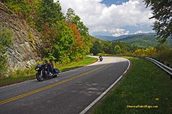
- Size (unfolded) - 11 x 17 inches
- Size (folded) - 4 1/4 x 5 1/2 inches
- Fast, simple, easy folding
- Layout - Full color map on one side with detailed directions and on the back
- Easy to read color-coded road labels to aid navigation
- Reliable and remote gas stations are shown
- Numerous points of interest
