#8 Best Rides NORTH of Smoky Park
More area covered, more roads, more attractions!
On This Map:
- 30+ Best Rides
- 20+ Good Connecting rides
- Scenic points, waterfalls, motorcycle-friendly stops, etc. shown
-
Remotely located (out-of-town) gas stations identified
- Handy, easy-to-use, accessible pocket map size
- Waterproof and durable
- Best rides boldly highlighted in red
- Good connecting roads highlighted in blue
- Rides are described on back of map
-
Mileage between road segments shown
- Overlaps and connects with adjacent maps
Description of area: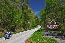
This map is purposely designed to help you get the most out of your rides on the busy north side of Great Smoky Mountains National Park. With some of the heaviest tourist traffic you'll find, knowing the secret back roads and short cuts through this area can turn an aggravating ride into an exhilerating adventure as you wind through the picturesque and historic foothills of the Smoky Mountains.
More than a dozen great rides are shown in red with another dozen or so good connecting roads shown in blue. This is the most detailed map I offer of the roads and attractions within Great Smoky Mountains National Park.
I've also identified the best of the roads leading into and out of the area. No matter which point of the compass you choose to reach the Interstates, I show the better roads to enjoy on the way.
Same features as all the other maps, packet sized, water / tear resistant, routes highlighted and color coded, easy to read, etc. Include the Dragon at Deals Gap, the Cherohlala Skyway, roadside waterfalls, and the most complete coverage of Great Smoky Mountains National Park of all the maps.
Features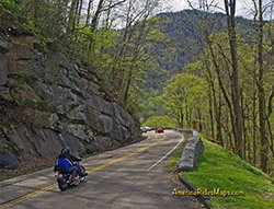
- Wheels Through Time motorcycle museum, - in Maggie Valley
- Cherohala Skyway - the Tennessee version of the Blue Ridge Parkway
- The Tail Of The Dragon™ at Deals Gap
- The Best approach to Deals Gap
- roadside waterfalls
- numerous attractions and points of interest
- Great Smoky Mountains National Park
Cities and Towns on this map:
Tennessee: Punkin Center, Vonure, Tellico Plains
North Carolina: Murphy, Andrews, Robbinsville, Bryson City, Highlands, Franklin, Maggie Valley, Cherokee, Hayesville, Cashiers, Cullowhee, Sylva, Dillsboro, Tuckaseegee, Glenville
Map Specifics: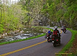
- Size (unfolded) - 11 x 17 inches
- Size (folded) - 4 1/4 x 5 1/2 inches
- Fast, simple, easy folding
- Layout - Full color map on one side with detailed directions and on the back
- Easy to read color-coded road labels to aid navigation
- Reliable and remote gas stations are shown
- Numerous points of interest
